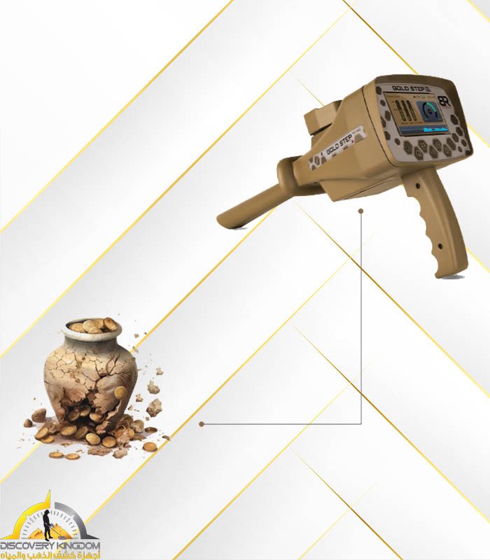
Features
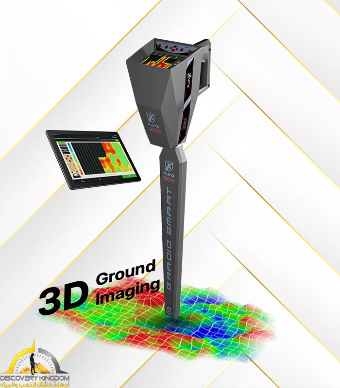
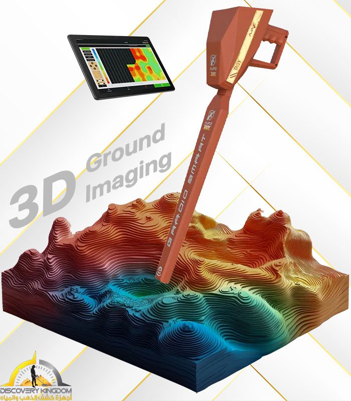
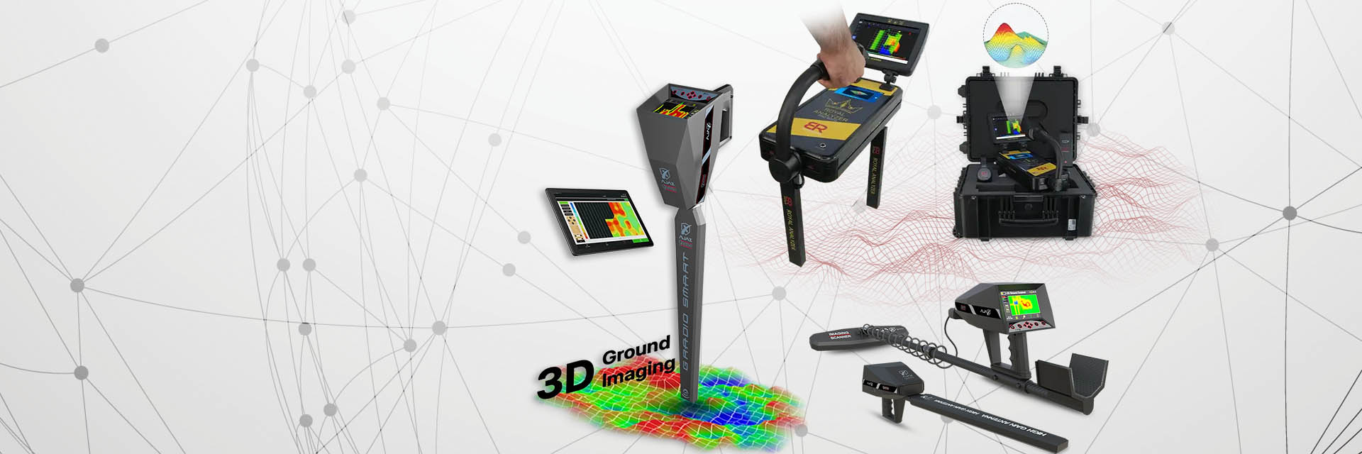
• The Ground Scope device operates on highly advanced technologies, including intelligent detection techniques and software. It scans and measures the Earth's layers to verify the presence of buried metals or voids. This is done through the radar sensor, which measures the Earth's layers and sends the received values to the main unit. The device then processes this data and displays it on the screen in two-dimensional and three-dimensional projections.
• The device specializes in detecting underground targets and distinguishing between them using different colors and numerical values simultaneously. It also clarifies the form and shape of the underground target.
• The device automatically and instantly determines the depth of all scanned points, displaying the depth value of each point directly on the screen.
• The device operates on two main detection and exploration systems:
- Live Scan System: This system provides the user with a direct scan and imaging of the Earth's layers to clarify and detect metals and voids, distinguish between them, and monitor their
location in real-time with a live broadcast on the device screen instantly.
- Ground Scan System (2D and 3D)
System Specifications:
• This system scans soil layers, identifies their contents, and reads the levels of electromagnetic fields and radiation to pinpoint and detect the locations of metals, treasures, and voids underground.
• A smart interface provides you with complete clarity and integrated results about targets and their locations in real-time.
• Precise target discrimination system.
• Graphic imaging system with an oscilloscope to determine the target's size and its start and end points.
• Interactive audio indicators accompanying the imaging data and graphs.
• Ground Scan System: This system allows the user to perform a complete scan of the area to be explored and immediately display the scan results on the device screen, determining the value of each point and revealing its identity and depth simultaneously. Additionally, it provides a two-dimensional and three-dimensional report of the discovered target from multiple viewing angles.
System Specifications:
• This system works to detect and scan the Earth's layers through a point-by-point scanning system, to image the ground and clarify the shapes and sizes of underground targets.
• There is no need to use complex analysis software, computers, or other tablets; the device provides you with instant results directly on its screen.
• Full control over the imaging scan process.
• Automatic ground scanning and imaging system.
• Manual scanning and imaging system.
• Control over the dimensions and size of the scan through several options displayed on the system screen.
• Measurement and imaging sensors with modern and advanced scientific technologies, fully specialized in identifying and detecting artifacts, buried targets, metals, and caves, and distinguishing between them.
• Clarification of the target's size and shape, along with a two-dimensional and three-dimensional illustrated report of the scanned area.
• Software with a very advanced technological level, giving the user easy and quick control over all device settings and system configurations.
• Comfortable and streamlined design that provides you with power in searching and mobility with light weight and ease of use, which plays a significant role in fast and uncomplicated results.
• The smart settings interface gives you flexible and quick control over all functions and easy access to all device settings.
• Device settings menu that gives you control over the following:
- Screen Brightness Control: Providing comfortable and suitable lighting with 5 different brightness levels.
- Sound Level Control: Providing precise and suitable sound control through 5 different sound levels or a silent mode as well.
- Language Control: Multilingual, allowing you to change the device's pre-saved language to another language.
• And for the first time globally in detection and exploration devices, and exclusively at MWF Group, the device is equipped with intelligent detection and operating systems, smart operating interfaces, a power-saving system, an intelligent charging system, a multi-language system with language retention, a settings حفظ system, and intelligent control.
• The device is characterized by its small size and ease of use, and the ability to disassemble and assemble the radar sensor unit.
• A control panel composed of shock-resistant pressure keys provides you with quick control over the device and settings.
• Automatic Tuning System (ATS): A special, new, and patented invention registered for MWF Group. This system provides accurate and confirmed results in all types of soil and terrain. This system automatically identifies the soil and provides the search with an automatic tuning that suits the type and properties of the soil, while eliminating any radiative interference resulting from the effects of rocky and mountainous lands that may affect many devices. However, this intelligent system can sort, analyze, and provide the necessary levels of frequency, voltage, and wavelength signals, thus providing results free of any errors.
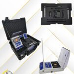
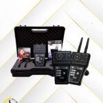
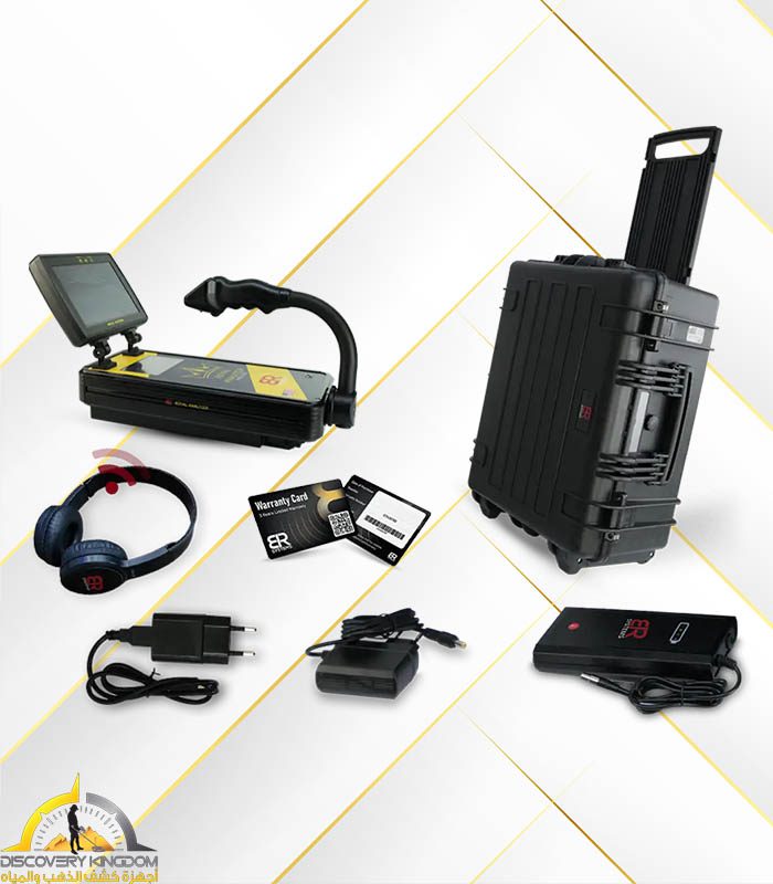
Accessories and Included Parts:
• Main unit of the device (control and processing unit).
• Radar sensor unit.
• Headphones.
• Electric charger.
• Device bag.
• Warranty card.
• User manual.
• Instructional disc.


Code of destiny –
I’m extremely impressed together with your writing abilities as smartly as with the structure to your weblog. Is that this a paid theme or did you modify it your self? Either way stay up the nice high quality writing, it is uncommon to look a nice blog like this one today!